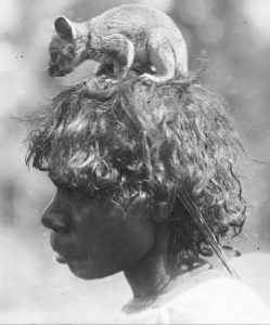
Aboriginal Songlines

Credit: David Hancock.
By Steve Trotter
Posted on 9th September 2023
Songlines
Aboriginal people travelled extensively throughout Australia along walking pathways called ‘songlines’ or ‘Dreaming Tracks’. They travelled along the songlines to important sites and places, to move to a seasonal campsite, to trade, and to visit other mobs. Songlines are not only the physical paths themselves but they’re the song maps used to navigate along the pathways that cross the land and the sea. They describe travel and trade routes, the location of waterholes and food.
When the local mob walked from one seasonal campsite to another they would often carry surplus food stocks with them to leave in special places indicated by the songline.
It was not uncommon for people to carry animals to restock the food supplies along the songline. Animals like posssums would be tossed into trees where food was scarce, or fish might be tipped from coolamons of water into isolated ponds. This ensured that other travellers walking the songline could easily find food if they were hungry.
The Songlines were made by Creator Spirits during the Dreaming. These paths trace the journeys of the Creator spirits over the land as they created landforms like rivers, valleys and mountains. Dreamtime stories are attached to the Songlines which are passed from generation to generation to keep the ‘maps’ alive.
Credit: Pinterest
Songlines can go just a few kilometres or thousands of kilometres. They can pass through the country of many clans and many Aboriginal nations.
The Nyangbal people of Ballina would travel a songline to attend the Bunya Nut festival in Queensland, along with many other clans from across the country; and the clans from Queensland and other places would travel to Ballina every few years for the Oyster Festival.
The inter-mob festivals were very important cultural events. Marriages would be arranged and trade conducted, and games and mock wars would be held. There was much feasting, singing, dancing, celebrating and information sharing.
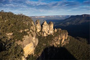
Another songline ran 3,500km along the length of the Great Dividing Range.

Photo from Encyclopedia Brittanica
In the previous blog I talked about my rugby mate, who was from a mob up in Northern Queensland, who told me he discovered hidden wells and Aboriginal caves around Bendigo. To give you an idea of how far it is, I once travelled on a bus from Brisbane in Queensland and then along the Great Dividing Range into Victoria where my route ended in Bendigo. The trip took 30 hours at 100 km an hour. For anyone to walk that far, it must have taken them weeks.
At the time I couldn’t fathom how he could possibly know where to look, let alone read the signs that pointed him to the hidden locations. Knowing how connected he was to his traditional culture though, my suspicion is that he’d been taught the songline that stretched from his country into Victoria. He could easily have used the detailed knowledge from the songline to navigate along the Victorian section of the route to locate the hidden wells and caves.
Credit: Ed Gifford / Radius Images
The Songlines over the land were often mirrored by sky Songlines. There are many Dreamtime stories that have been woven into the stars, much the same way the Greeks grouped constellations to form astrological signs which sailors used to navigate across the seas. The sky songlines would have used the stars in a similar way, allowing people to navigate vast distances over the land and the sea. One of the most well-known stories is the Dreamtime story of the Seven Sisters.
How old are they?
Scientists have recently discovered just how ancient the songlines are when they followed a songline to a significant site beneath the sea. Water levels were much lower, thousands of years ago, and many Aboriginal people lived on land that was much further away from the present coastline. Scientists recently collaborated with the Murujuga people in Western Australia to be guided to a site tens of kilometres off the coast of Western Australia. From this site scientists and the traditional custodians were able to prove the existence of a songline that ran from Dampier’s Point in Western Australia across the country to Uluru and then into the Northern Territory.
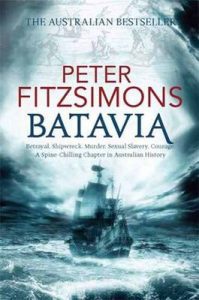
Peter Fitzsimons unknowingly identified a significant site that would be attached to a songline on Hayes’ Island in his historical novel ‘Batavia’. ‘Batavia’ recounts the infamous events of the Dutch shipwreck of the Batavia off the coast of Western Australia in the 1600s. In it, Fitzsimons describes how members of the crew, who were marooned on a separate island by the mutineers, discovered wallabies and a covered waterhole, while searching for water. These two single discoveries by the crew strongly suggest Aboriginal people had visited the island in the past.
Aboriginal wells were often deliberately covered with flat rocks to preserve the water beneath and animals would be transported to far away places to ensure future food supplies would be there, much the same way that the European explorers used to leave pigs and goats on islands as future food reserves.

‘The waterhole that enabled the soldiers abandoned on Wiebbe Hayes’s Island to survive. (Newspix/Andy Tindall)’ from Fitzsimons’ novel, ‘Batavia’.
Rules of Travel

Credit: Michael Terry, National Library of Australia, nla.obj-149085777
There were some strict rules that had to be followed though. You could use the songlines to cross another mobs’ territory if you walked along the songline and did not venture far from it. Also, when you camped you were required to light a fire to let the local mob know you were there. The local clan would send someone over to check you out, a bit like a customs’ check. If you were travelling for legitimate reasons and acting respectfully you could access food, water and shelter without being harassed by the local clan.
Songlines contained information about the land and how the traveller should respectfully travel across it. This included information about where the traveller could find food and water, places to be avoided and the boundaries of each Mob’s Country that the traveller was passing through.
Why were they called songlines?
They were called songlines because the Creator spirits sang the original song of the route. This route or Dreaming Track was passed on as a song from generation to generation.
The traveller who sang the song could walk in the creator’s ‘footsteps’ to navigate across the country in the same way that someone follows a map. The songs served the same function as paper maps and mobile phone maps that guide us to our destinations today. The big difference was that the songs were not reliant on technology or a cartographer’s map but on a song memorized and shared with another person. The use of song to remember travel routes made it much easier for people to memorise the directions.

Musical Maps
Aboriginal Australians embedded musical rhythms into their oral maps to remember complex pathways to sacred and significant sites. They used similar strategies as those used by Homer, the storyteller from ancient Greece. Homer was blind but could recall the story of the Trojan War in great detail. In ‘The Iliad’ Homer lists hundreds of people who fought on both sides of the war, identifies their forebears, and recalls significant details of the events, people and places. He was able to do this because he had committed the story to memory.
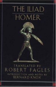
Credit: openlibrary.org
The poem is so long that when it was finally written down, much later, it was the size of a large novel. The process of using musical influences to transform information into verse poetry added a memorable pattern to the text making it much easier to remember. It seems incredible that he was able to memorise such a huge story, word for word, but Homer would have turned to techniques used by the Greek dramatists who employed well-known tricks and tips to remember their lines for lengthy plays.
The techniques Homer used would have been very similar to the ones used by the Aboriginal people of Australia to memorise their musical maps that guided them across the country.
What sorts of things would have been included in the musical map?
The songlines identified landmarks along the route – like rivers, mountains, trees – that the traveller should watch out for to keep them on the right track:
‘A well-known marker is the scar-tree near the Heide Museum of Modern Art in Bulleen. This scar-tree is called ‘Yingabeal’ (Yinga meaning sing or song and beal being the Wurundjeri name for a redgum). Yingabeal marks the point where five different Songline routes meet and come together. Other examples of ‘signposts’ or ‘markers’ include rock formations, bends in rivers, or trees with naturally forming spirals, twists or arches.’
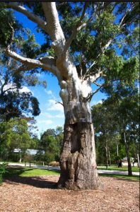
Credit: Doncaster Templestowe Historical Society
The Impact of Colonisation
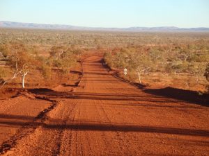
Before colonisation the songlines were maintained by regular use, burning off and clearing. It was every mobs’ responsibility to maintain their section of the songlines. The routes were wide and well-tended in every mobs’ country making travel very easy across the country.
In fact, after the British invaded, settlers reported how easy it was to move their horse drawn carts on what they thought were natural pathways, not realizing (or not caring) that the pathways had been created by Aboriginal people thousands of years ago.

Credit: Sketch by Col. Mundy
Tragically, when the British claimed Australia as an extension of their Empire they dismissed the fact that Aboriginal people had made these paths. The British categorised them as ‘animal tracks’ or ‘natural clearings,’ to justify their invasion of Aboriginal land. The British systematically destroyed any signs of Aboriginal civilisation to justify their invasion. Any signs of an existing civilisation prio to theirs ran contrary to their agenda that Australia was a Terra Nullius, a land of nothing, inhabited by primitive people.
Credit: Pinterst user
The songlines were rapidly transformed into cart-tracks, then gravel paths, and then the bitumen roads we drive on today. The Nepean Highway, Dandenong Road, Plenty Road, Heidelberg Road, Geelong Road and Ballarat Road, are all roads in Victoria that were once Aboriginal songlines.
Want to Know More About Aboriginal Culture?
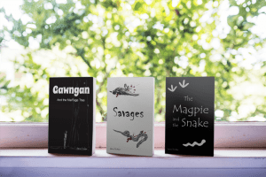
If you or your children would like to know more about Aboriginal history and culture, check out Magpie Publishers’ bookstore. Steve’s stories incorporate the information from these blogs to celebrate Australia’s First Nations’ People and to build respect for their culture.
Walk on Country
We acknowledge the Traditional Custodians of Australia and honour the Elders past and present.
© Steve Trotter 2023


